

Lycian Geology and Earthquakes: A Civilisation Rising on Moving Ground
📌 Contents
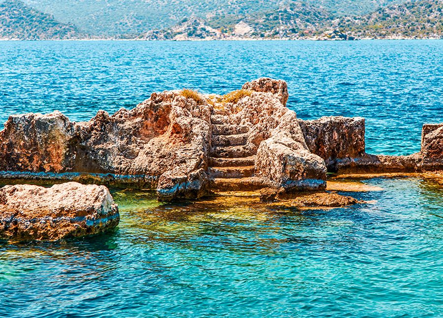
Lycian geology and earthquakes began writing the story of the Land of Light long before people first worked its stone. In this landscape, the ground is not just a surface to live on. It is a living structure that rises, sinks and, from time to time, shakes the cities built on it. The steep cliffs along the coast and the steps now lying underwater are visible traces of these movements today.
Ancient Lycia stands on the rugged mountains of the Teke Peninsula. To the south, deep beneath the Mediterranean, the African Plate dives beneath the Aegean-Anatolian Plate, making the Eastern Mediterranean one of the most seismically active regions in the world. Lycia’s history is not only a history of kings and wars, but also of the great energy beneath the earth.
🏛️ 1. Lycian Geology and Earthquakes: The Region’s Tectonic Setting
To understand how Lycia looks today, we need to look at two main structures that affect the region.
- The Hellenic Arc and subduction zone: Running south of Crete and Rhodes towards the waters off Lycia, this line is formed by the northward descent of the African Plate. It is the source of the largest earthquakes, and of some tsunamis, in the history of the Eastern Mediterranean. Lycia lies close to the complex zone where the Hellenic Arc meets the Cyprus Arc to the east.
- The Fethiye-Burdur Fault Zone: Stretching north-east from the Gulf of Fethiye towards Burdur, this earthquake belt is one of the most active areas of south-west Anatolia. One of the earthquakes that most affected the region in recent history was the great Fethiye earthquake of 1957.
🏛️ 2. Earthquakes That Changed History and the Legacy of Opramoas
Lycian inscriptions show that earthquakes brought not only destruction, but also solidarity.
- The earthquake of AD 141: One of the most destructive known earthquakes in Lycian history, it caused severe damage to many cities. Opramoas, a wealthy benefactor from Rhodiapolis, made generous donations towards the rebuilding of around 30 Lycian cities after the disaster. His gifts are recorded in detail in the long inscription carved on the walls of his monumental tomb at Rhodiapolis, one of the most important sources documenting solidarity after an earthquake in the ancient world.
- Late Antiquity and after: Earthquakes continued to strike Lycian cities in later centuries. In the Eastern Roman (Byzantine) period, many coastal cities slowly declined because of earthquakes, silted-up harbours and changing trade routes.
🏛️ 3. Memory Beneath the Waters: Kekova
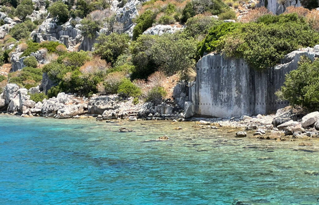
Kekova is where the relationship between earthquakes and the coastline can be seen most clearly in Lycia.
- The sunken remains: The ruins shown on boat trips as the “Sunken City” lie along the northern shore of Kekova Island and are usually identified with the ancient town of Dolichiste. Submerged stairways, house foundations and harbour structures can be seen from the boats.
- Simena and Aperlai: Submerged structures can also be found at Simena (today’s Kaleköy) on the opposite shore, and at Aperlai to the west.
- Why did they sink? The submergence of parts of these settlements was not the result of a single earthquake, but of tectonic subsidence, earthquakes and changes in sea level over many centuries.
Three Key Traces of Lycian Geology
| Event | Area affected | Result |
|---|---|---|
| Tectonic subsidence | Kekova, Simena, Aperlai | Parts of settlements sinking below the sea |
| Alluvial deposits | Patara and the Eşen River | Silting of the harbour and loss of the city’s link with the sea |
| Carving into bedrock | Myra, Pinara and other necropolises | Most rock-cut tombs surviving to the present day |
Building Skill Against Earthquakes
Lycian builders learned to live in a land of earthquakes. They raised mortarless walls of large, precisely cut stone blocks and linked the blocks together with metal clamps, techniques that made their buildings more resistant to tremors. Rock-cut tombs, carved directly into the bedrock, also suffered less damage than free-standing buildings, though many still show earthquake cracks. For more architectural details, see our page on Lycian Architecture.
Tips for Travellers
- Look closely at the ruins: When visiting ancient sites, look at fallen columns and displaced wall blocks. Archaeologists try to read the traces of past earthquakes from clues like these, in a field known as archaeoseismology.
- Watch the shoreline at Kekova: On a boat trip, look not only at the water but also at the rocky shore and the underwater steps. You can see how the coastline has changed over time.
- Current earthquakes: You can follow current seismic activity in the region through AFAD (Türkiye’s Disaster and Emergency Management Authority) and the Kandilli Observatory.
A History Written by Earthquakes
Lycian geology and earthquakes are among the most important forces that shaped the character of this civilisation. Lycia’s story shows how people could endure the power of nature through solidarity and skill. Every step we see underwater today also reminds us how we should build the future in this restless land.
🏛️ Frequently Asked Questions (FAQ)
When was the most destructive earthquake in Lycia?
One of the most destructive known earthquakes struck in AD 141 and caused severe damage to many Lycian cities. Afterwards, the benefactor Opramoas helped rebuild around 30 of them.
Why is Kekova underwater?
Parts of the settlements on and around Kekova sank beneath the sea as a result of tectonic subsidence, earthquakes and changes in sea level over many centuries.
How did ancient buildings withstand earthquakes?
Lycian builders raised strong walls of large, mortarless stone blocks joined with metal clamps. Rock-cut tombs, carved into the bedrock, were also less affected by earthquakes than free-standing buildings.