

Kitanaura Ancient City: The Capital of the Beydağları Above the Clouds
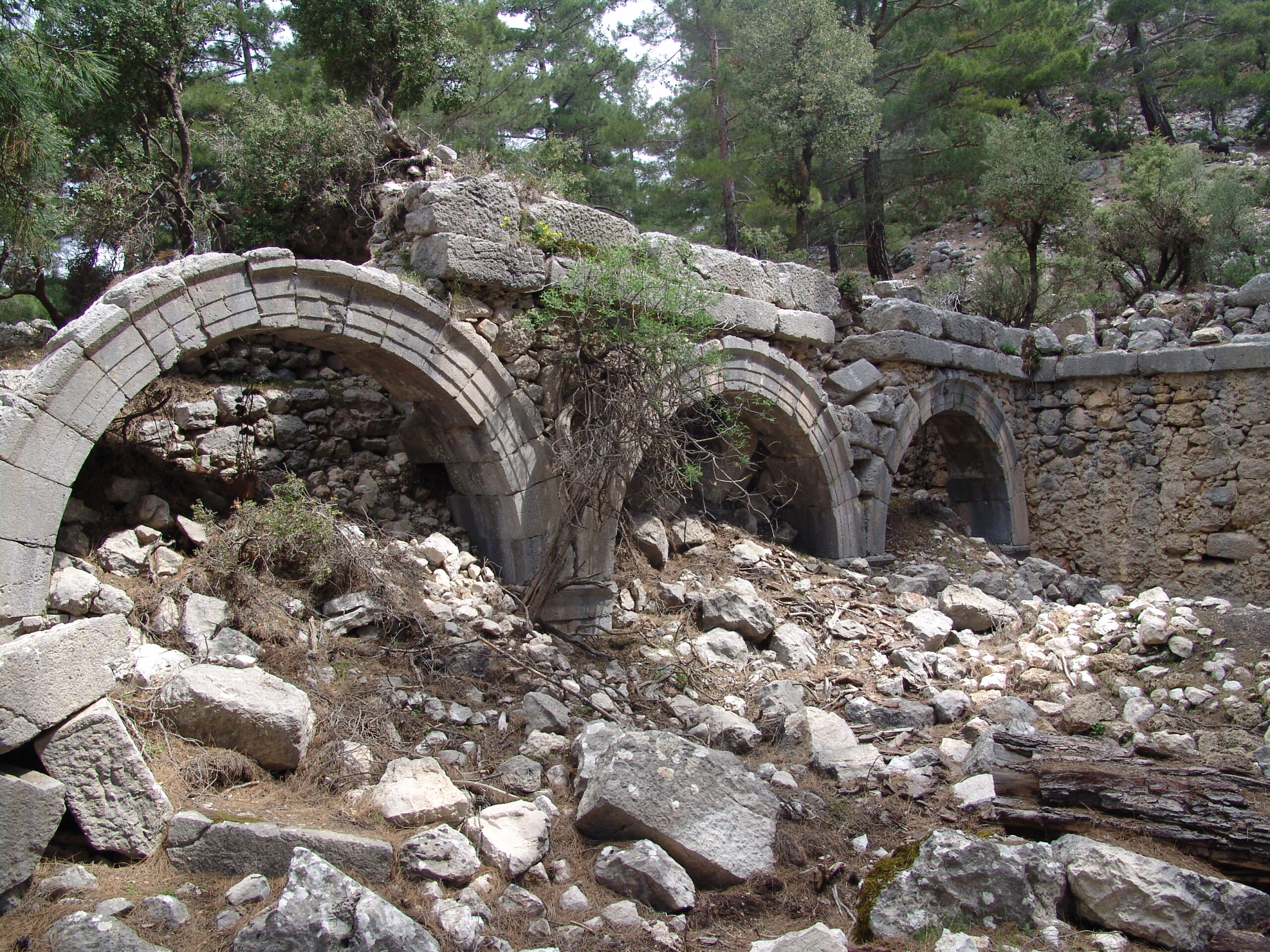
Located within the boundaries of the Kumluca district of Antalya, on the commanding hills north of the Saraycık locality, Kitanaura Ancient City is a special settlement reflecting the logistical and military ingenuity of the ancient world. The city’s name was a subject of debate for many years; it was first visited in 1842 by Spratt and Forbes, who mistakenly identified it as “Apollonia”. Later confused with Mnara, the settlement finally gained its definitive identity thanks to the famous Stadiasmus Patarensis (the Patara Road Monument) unearthed in Patara.
According to data from the road monument, Kitanaura is located approximately 18 kilometers from the Idebessos Ancient City and formed one of the most critical frontier borders under the sphere of influence of the powerful city of Termessos during its period.
Three Eras, Three Walls: The Defense System of Kitanaura
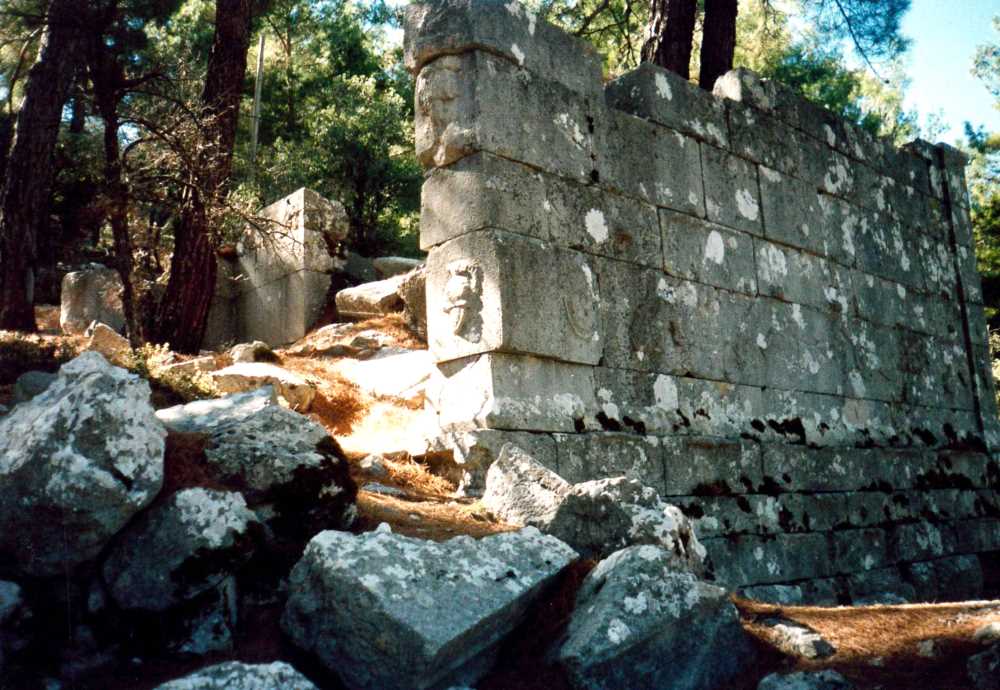
The most remarkable architectural feature of Kitanaura is the defense system that wraps around the acropolis like a suit of armor. Archaeological surface surveys indicate that the fortification walls of the city were constructed in three distinct phases:
- Hellenistic Period Fortifications: Dating to the 1st century B.C., this first phase consists of large, uniform blocks laid in the “isodomum” technique. The drafting of the edges of these blocks reflects the aesthetic and military power of the city during that era.
- Roman Period Fortification Additions: Mortar was utilized in this section, which was built upon the original walls using the polygonal technique. It is possible to see “spolia” (second-use blocks taken from older structures) inside these walls.
- Byzantine Period Defense: Positioned at the outermost layer, these fortifications were built using rubble stone and dense mortar. This stands as the most concrete proof that the city was actively defended until the Middle Ages.
As an interesting detail, no tower structures have been encountered along these massive fortifications, demonstrating how significantly the natural rock formation of the city contributed to its defense.
The City Center: Agora, Basilica, and Public Buildings
Kitanaura was not merely a fortress; it was a “polis” (city-state) with a developed social fabric. When entering from the southern gate, a wide plain welcomes visitors:
- Agora and Shops: Surrounding the agora, which is considered the heart of the city, are three adjacent independent spaces (likely shops). This area was the hub of trade and social life in antiquity.
- Monumental Public Buildings (Y-31 and Y-32): Located east of the agora, these two large buildings feature colonnaded (porticoed) facades and monumental entrances. Constructed with bossed blocks, these buildings represent the administrative and cultural authority of the city.
- Byzantine Basilica: Built west of the agora during late periods, this large three-nave basilica emphasizes the importance of Kitanaura during the Christian era. The mention of the city in episcopal lists as a center affiliated with the Metropolis of Perge reinforces the significance of this religious structure.
You can find more technical details regarding the architectural richness and construction techniques of the city on our Lycian History page.
The Necropolis and the Ancestor Cult
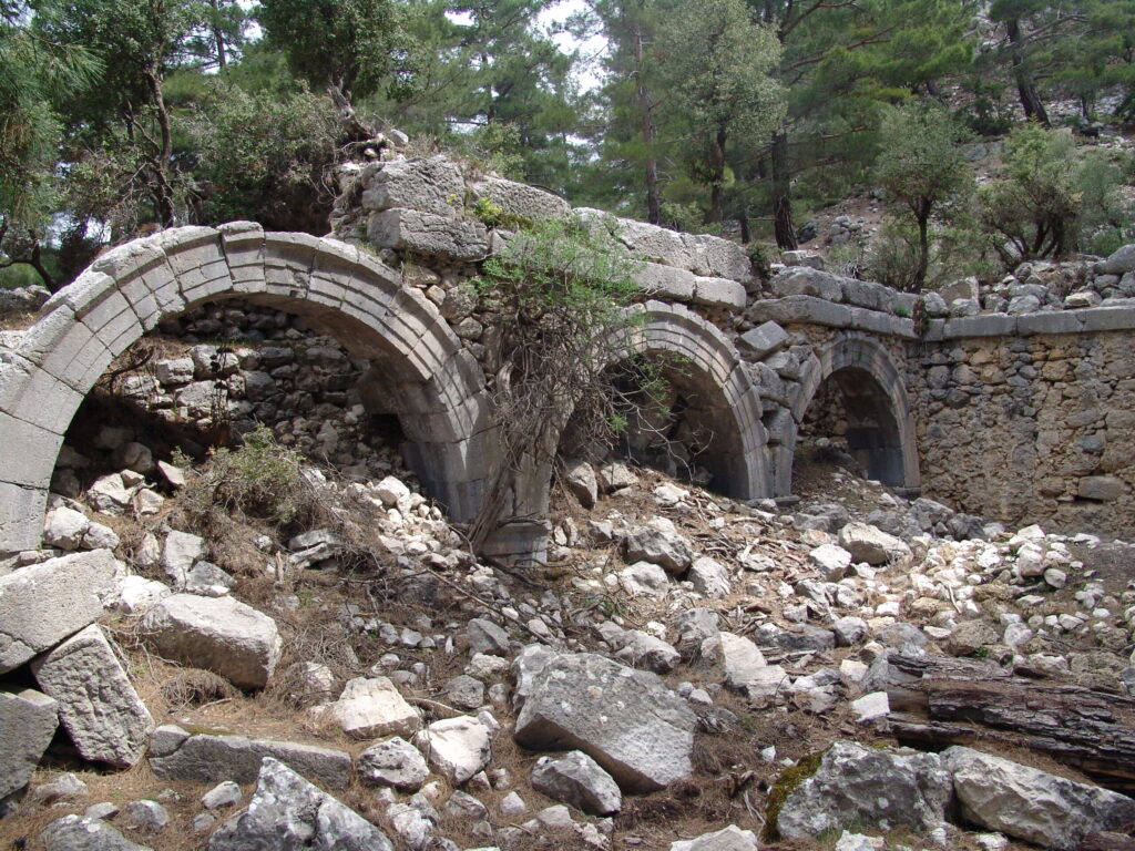
The necropolis (cemetery area) of the city spreads across the lower sections of the acropolis in the western and northern directions. Here, classical Lycian burial traditions and Roman influences are interwoven:
- Sarcophagi and Chamosoria: Rock-cut tombs and magnificent sarcophagi form the main fabric of the necropolis.
- Monumental Tombs: The monumental tomb located beneath the modern road draws attention as one of the best-preserved examples in the region.
- Niches and the Ancestor Cult: Niches carved into the rocks at the southern entrance of the city bear traces of the belief in founding heroes and ancestors (Ancestor Cult).
You can examine our Lycian Flora guide for rare species growing in this rugged geography of the region, and our Lycian Fauna guide for the wildlife.
🏛️ Mysterious Coins with the “Kita” Legend
The Kitanaura Ancient City held the authority to mint coins in its own name during the Hellenistic period. The inscription “Kita” on these coins stands as the grandest proof of the economic and political independence of the city during that era. If you pay attention to the masonry work in the agora section of the city during your visit, you can observe how this economic power reflected onto the architecture. Do not forget to follow the website of the T.R. Ministry of Culture and Tourism for current travel notes and excavation statuses for 2026.
🏛️ Frequently Asked Questions (FAQ)
Where is Kitanaura Ancient City and how is transportation provided?
It is in the Saraycık locality of the Gölcük Neighborhood, connected to the Kumluca district of Antalya. You can reach Saraycık by following the highland roads from Kumluca, and arrive at the archaeological site via a short climb from there. Due to rough terrain conditions, choosing a high-clearance vehicle is recommended.
What is the connection between Kitanaura and Termessos?
Ancient sources and road monuments indicate that Kitanaura was a frontier settlement (frouria / fortress-city) within the sovereignty borders of the massive Pisidian city of Termessos.
What is the meaning of the name Kitanaura?
The legend “Kita” is observed on Hellenistic period coins. It is estimated that the name is of Luwian origin and refers to the geographical structure of the region (mountainous/high place).
Is there an admission fee and is the Museum Pass (Müzekart) valid?
Currently, there is no ticket booth at the entrance of the archaeological site, and admission is free. However, the region is a registered first-degree archaeological site.