
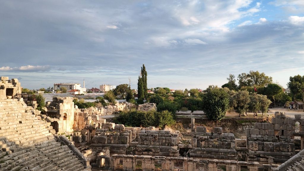
Visitors to Myra Ancient City first see, on a rocky slope rising among Demre’s greenhouses, the Lycian tombs carved into the cliff, and just in front of them the largest theatre in the region. But this view is only the visible face of a great city. Myra’s streets, agora, temples, baths, houses, in short the whole great city, lie today beneath Demre, under alluvium carried down by the Demre stream over centuries, up to 10 metres deep in places, and under today’s greenhouses.
Myra was no ordinary Lycian city. It was one of the six great cities with three votes in the Lycian League, and in the Roman period it bore the title “metropolis”. Its wealth came from the harbour of Andriake a few kilometres to the southwest, and from the great trade routes of the Mediterranean. In the 4th century the city’s bishop was St Nicholas; the church, seminary and martyrium/tomb of the saint, known around the world today as Santa Claus, made Myra a pilgrimage centre for centuries. In the 5th century AD, under Theodosius II, Myra became both the religious and the administrative capital of Lycia.
The oldest trace of this layered past came as a surprise of the excavations. Chalcolithic pottery found in soundings in the theatre’s orchestra pushes life on this coast back 6,000 years. Lycian dynasts, Roman merchants, the Christians of the Eastern Roman (Byzantine) period and the communities who lived here long before them: the traces of all of them lie beneath the same soil, one on top of the other.
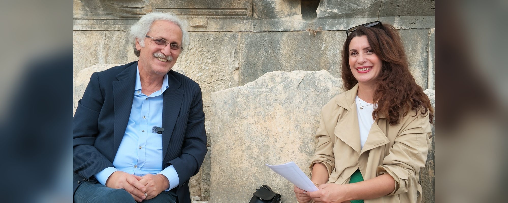
Archaeologist Prof. Nevzat Çevik of Akdeniz University has directed the excavations at Myra and Andriake since 2009. We met Çevik, who has been digging this ground for 17 years, on site on 5 November 2026; the questions were asked by Mine Barışık. The conversation turned around the Myra that visitors cannot see: the metropolis beneath the soil, the city’s 6,000-year past, the harbour of Andriake and Sura. (Quotations translated from Turkish.)
A site nobody had chosen
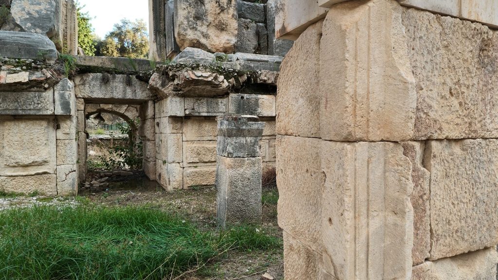
According to Çevik, nobody before him had dared to choose Myra for an excavation. He explains why: “It was very difficult. A city covered by 10 metres of alluvium, with groundwater problems and private-ownership problems.” When the team arrived in 2009, not a single stone had been excavated at Andriake; all the remains lay hidden under dense vegetation. At Myra, as Çevik recalls, “the upper parts of the theatre were visible, but nothing of the stage building.”
Why is Myra Ancient City “the Pompeii of Anatolia”?
Çevik explains the comparison with Pompeii through the layer of earth over the city: “There is a thick quilt on top of it, and that quilt is up to 10 metres thick. The alluvium carried for hundreds of years by floodwaters from the Myros valley has covered the whole city.” He adds: “Of course it was not covered by lava. But it too was covered, by alluvium.”
Geophysical surveys show traces of a large city, one and a half to two kilometres across, stretching from the theatre to the Church of St Nicholas and the valley. “Under every part of the Demre you see, Myra is lying,” Çevik says. “Right now you only see its theatre. And even the theatre gives an idea of the city’s size, because it is the largest theatre in the region.”
A city under the greenhouses
Is it a loss that the city lies under greenhouses? Çevik’s answer is not what one might expect: “There is also a pleasure in not opening this information package, in not being able to open it. That is a difficult sentence for me, because of course one wants to see. But we are giving the distant future a very good package, preserved. It does not matter that there are greenhouses on top; the ancient city is 10 metres below the greenhouses anyway. Today they farm, they run greenhouses on fertile land; very important agricultural income, of course. But if someone were to dig 200 years from now, they could find the city intact, completely undamaged, with all its layers, because the soil protects it. And who knows what unknown, dark chapters of Lycia and Myra might come to light.”
A 6,000-year trace on the coast
The most valuable find of the excavations is not a statue but a few sherds of pottery. Soundings in the orchestra of the theatre reached Chalcolithic pottery at a depth of about 3.5 metres. The find matters because of where it is. In Lycia, traces of settlement this old were expected in the farming highlands inland, not on the coast. Çevik puts it this way: “This is not supposed to happen. You do not expect it from coastal Lycia. (…) In mountainous Lycia, in a farming area, it is normal; there can be Neolithic, there can be Chalcolithic. But finding Chalcolithic here was truly remarkable. We pushed Myra’s history back to 6,000 years.”
For Çevik, these few sherds are the most important result of the excavation: “Because they tell the city’s birthday, those 8–10 sherds are the most important thing for me. More valuable than a hundred statues. Because they prove that from the Chalcolithic onwards there was life, there was settlement, on the Lycian coast.”
He sums up what gives a find its value in archaeology: “The strength of the information it carries (…) If you saw those sherds in the street you might kick them aside, but they are important. Handmade pottery; there are fingerprints. I place my finger on them, and it fits.”
“The sea of Myra” and Bronze Age wrecks
For Çevik, understanding Myra’s early past means looking not only at the soil but also at the sea. In the Bronze Age, the Lycian coast lay on one of the busiest sea routes of the Mediterranean. The Uluburun wreck off Kaş, the wreck at Cape Gelidonya and the Kumluca wreck found a few years ago prove that there was intense trade in these waters in the 2nd millennium BC. In Çevik’s words, “These show the intense cultural and commercial traffic there was in the Bronze Age.” The latest link in this chain is older than all of them: the wreck recently discovered by Hakan Öniz off Kekova, dated to 2700–2400 BC. Çevik stresses that it was found in Myra’s waters: “Again here, in the sea of Kekova. I call this the ‘sea of Myra’, because all the very small settlements here were tied to Myra.”
You can read about the Kekova wreck, as told by excavation director Assoc. Prof. Hakan Öniz, here.
From Muri to Demre: the journey of a name
Çevik, who proposed Muri as the city’s Lycian name, explains that he arrived at it by comparison with the neighbouring city of Limyra: “In the Classical period we know Limyra’s name: in Lycian it is written Zemuri. If that is Zemuri, this becomes Muri.” In Ancient Greek, Muri became Myra. Medieval portolans call it Stamirra, and al-Idrisi calls it Al-Mira. According to Çevik, the name that finally became Demre means myrtle: “It is the plant from which Adonis was born, and it is identified with Artemis, the goddess of vegetation. On Myra’s coins the city’s goddess Artemis is shown with her lower half as a tree: half tree, half human.”
The earliest gathering place in Lycia, on the acropolis
The rocky hill just behind the theatre is where the Lycian dynasts lived in the Classical period, and the rock tombs on its slopes are theirs. “Here, 13 tombs carry very rich relief panels and friezes,” Çevik says. “And 23 tombs have inscriptions in Lycian and Ancient Greek; we also know whom they belonged to.”
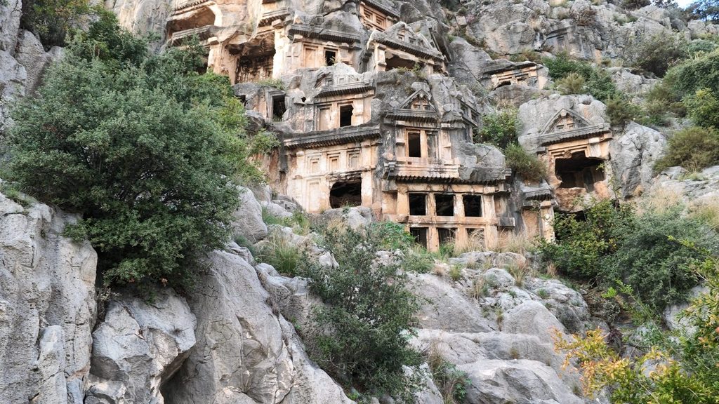
On the roadless acropolis, the team climbed the slope every day to excavate. The result was the earliest known gathering structure in Lycia: a rectangular space for 153 people, carved into the rock. Çevik deliberately does not call it a meeting hall: “In the dynastic period there is no council; that is why I did not say ‘meeting hall’ but ‘gathering place’. They gathered there for funeral ceremonies, social ceremonies, festivals.”
Andriake: Myra’s free zone
The source of Myra’s wealth was Andriake, one of the great harbours of the Mediterranean. Because it was not intertwined with a city, Çevik says, it is the place where harbour buildings can be read most clearly: “Andriake is a harbour; not a civil settlement, not a city. That is why it is the place where we best understand harbour urbanism.” Çevik sums up the harbour’s importance: “The harbour has the largest granary in the region, an agora, shops and workshops, a shipyard and slipways, five churches and a synagogue. These buildings, which bear strong traces of an importance that peaked in the Roman period and of international cultural and commercial traffic that reached its height in the 5th century AD, show that the harbour was one of the most important ports of call in the ancient Mediterranean.”
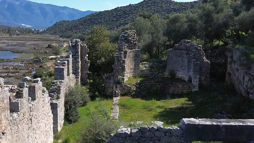
A document showing the harbour’s importance for the whole region was also found here: the customs law of the Lycian League. Çevik sees the inscription as evidence that this was the League’s central harbour: “It sets out the harbour laws, in the name of the Lycian League; not only in Myra’s name. It becomes a central place for the League.” Dated to Nero’s reign, in the early AD 60s, the inscription is longer and more detailed than similar customs inscriptions known in Anatolia, at Ephesus and Kaunos.
Çevik compares the harbour to today’s free zones: “Because this was an independent harbour outside the city, it worked like an emporion serving the whole region and all international traffic, like a free zone.” In his view, “the fact that Andriake is filled entirely with buildings for international trade shows that it was an emporion. Indeed, it is called an emporion both in the Nero inscription and in the vita of Nicholas of Sion.” He calls the great cistern in the middle of the harbour “our sunken palace”: “Nobody excavates a cistern in archaeology. We did something crazy there too and excavated the cistern.” The Hadrianic granary (Horrea Hadriani) now welcomes visitors as the Museum of Lycian Civilizations.
We will cover the excavation at the former industrial estate between Myra and Andriake, and the structure Çevik has identified as “a Roman cold thermal facility, a healing-water building, a spa”, in a separate story.
Sura: prophecy by fish
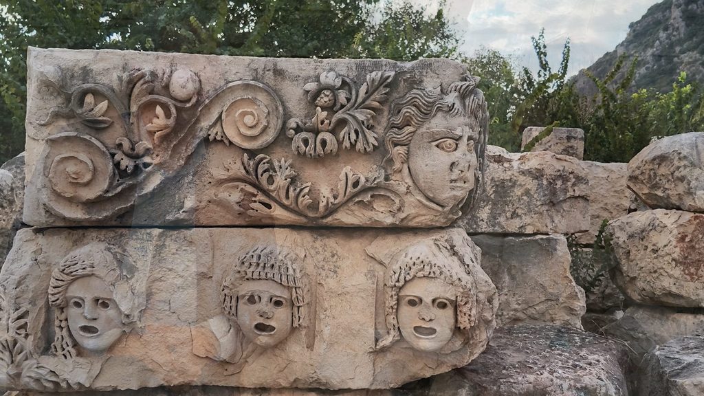
Sura, Myra’s oracle centre, was not a city, Çevik says, but a quarter of Myra, like Andriake: “Just as Andriake is the harbour quarter here, Sura is like a temple quarter.” At the temple of Apollo in the valley, priests read the future from the movements of fish in the pool. Çevik says he applied to excavate Sura some 15 years ago, but permission is not given to one excavation director for a second city.
What comes next?
At Andriake the central area is nearly complete; next comes the north side of the harbour. “We have not touched the northern town at all. I think it will shed light on the harbour’s dark age, the 8th century AD and after,” Çevik says, adding: “My lifetime will not be enough. But those who come after me will surely excavate there.” At Myra, next comes the restoration of the theatre. With its project completed and submitted for ministry approval, the theatre will rise again, in Çevik’s words, “with its columns, with its scaenae frons completed”.
You can watch the full interview in the video above. Our separate interview with Prof. Nevzat Çevik on the Lycian Way will be published soon.
Related: The Bronze Age wreck off Kekova · Three new protection decisions in Kaş and Demre
Sources
- Interview with Prof. Nevzat Çevik, Myra, 5 November 2026 (Voice of Lycia, video: https://www.youtube.com/watch?v=HKEtOoquBaw)
- Çevik, N. (2022). The Book of Lycia: Archaeology, Culture and History in Western Antalya. Ankara: Turkish Historical Society (TTK), 611 pp.
- Çevik, N. and Bulut, S. (2022). “Andriake, Port of Myra: Remarks in Light of New Evidence”. Türk Arkeoloji ve Kültürel Miras Enstitüsü Dergisi 2, pp. 7–74.
- Lycian Monuments: Andriake (customs inscription)
- Takmer, B. (2007). “Lex Portorii Provinciae Lyciae: Ein Vorbericht über die Zollinschrift aus Andriake aus neronischer Zeit”. Gephyra 4.