
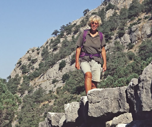

The Land of Light Through the Pen of
Kate Clow
✍️ Editor’s Note: This text has been penned by Kate Clow, who discovered, marked, and brought the Lycian Way to the world’s cultural heritage in 1999. It stands as the original narrative from the founder of Turkey’s very first long-distance walking route.
The Lycian Way (Muğla-Antalya): A Legacy Since 1999
Opened in 1999, the Lycian Way is consistently ranked among the top ten best walking routes in the world, with approximately 12,000 people hiking this long-distance trail every year. Regrettably, the vast majority of these hikers are foreign tourists. Being able to see the Lebanon cedars, snowdrops, crocuses, and countless other natural beauties along the skirts of Mount Tahtalı is a privileged experience to be had on your southern coasts, which have otherwise been exposed to heavy cultural erosion and visual pollution.
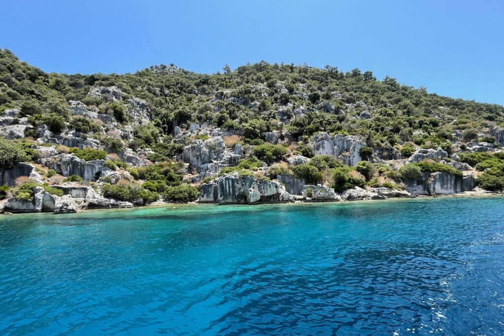
Lycia, historically known as the “Land of Light,” is the ancient name of the Teke Peninsula, whose boundaries stretch north to Burdur, west to Fethiye, and east to Antalya. The earliest literate settlers of the region referred to themselves as the Termilae (Trmmili-Dirmil) and presumably inhabited the Xanthos Valley and its surrounding mountains. Tlos, Pinara, Myra, Olympos, Xanthos, and Patara stand out as the major settlements of the area. By 1000 B.C., Lycian mercenaries were already fighting in Syria and Troy. The Lycians initially spoke a language heavily influenced by the powerful Hittite Kingdom in Central Anatolia, and later developed a script inspired by the Phoenicians.
Under pressure from the Phrygians to the north, the Lycians spread toward the coastal areas where they established contact with Greek colonists, who were building cities like Phaselis. Although Lycian culture absorbed Hellenic influences over time, it fiercely preserved its own native language and characteristic tribal unity. Having weathered periods of Persian, Delian League, and Roman hegemony, the Lycians formed the highly organized and harmonious Lycian League in 205 B.C., establishing Xanthos as their capital. Due to its strategic importance in controlling maritime trade routes, the region eventually became a Greek-speaking Roman province in 43 A.S. (A.D.).
For a deeper exploration into the origins of these regional civilizations, you can browse our Lycian History page, where we cover the groundbreaking academic theses of Prof. Dr. Fahri Işık.
Lycian Way Route Details and Trail Information
The Lycian Way is Turkey’s pioneer long-distance walking trail. With the assistance of accurate maps and route descriptions, you can enjoy a safe and delightful trek along the 650-kilometer Lycian coast by following the standard international red-and-white trail markers. Yellow-and-green signposts guide hikers at crossroads where the trail leaves paved asphalt roads. Stretching between the Fethiye district of Muğla and the Sarısu Neighborhood of Antalya, this path allows you to explore more than twenty ancient Lycian cities.
The route follows the Mediterranean coastline through a breathtaking combination of natural and historical wonders, including Fethiye, Kabak Bay, Yediburunlar, Letoon, Xanthos, ancient aqueducts, Patara, Kalkan, Kaş, Kekova, Myra, Finike, Adrasan, Olympos, Çıralı, Phaselis, Mount Tahtalı, and Göynük Canyon. The trail does not merely hug the shoreline; it frequently climbs steep cliffs, drops down into sandy beaches, and winds into historic harbors. Passing through high-altitude alpine meadows (yaylas) and dense woodlands, the route reaches its highest pinnacle above the cedar forests of Mount Tahtalı at an elevation of 1,800 meters. You can study the region’s unique plant life in our dedicated Lycian Flora section.
Depending on individual fitness levels, the entire path can be completed in 4 to 6 weeks. Alternatively, hikers can break the trail down into smaller stages to plan daily or weekly excursions. Unless you are hiking at higher elevations, the months of July and August are exceptionally hot for trekking. December and January are typically stormy, while April brings heavy rainfall. However, the windows between February and June and September and November are ideal for walking the entire route or specific sections. Snow generally blankets areas above 1,500 meters from January until early April, and heavy downpours can be expected starting in September. We highly recommend reading our Lycian Fauna guide to learn about the wildlife species you might encounter during this journey.
Guidebook, Transportation, and Lodging Options
The official guidebook, available in Turkish, English, and German, contains comprehensive information regarding the Lycian Way. The entire route is broken down into daily stages and described in meticulous detail, alongside rich historical and archaeological data about the ancient sites along the trail. Because the Antalya region sits directly on major bird migration corridors and hosts numerous endemic orchid species, carrying a regional flora or bird reference guide with you will prove highly beneficial.
🏛️ Info Note: Cultural Routes and Sustainability
To learn more about the association founded by Kate Clow that oversees the maintenance of the Lycian Way and many other historic trails, to track recent route changes, or to volunteer, you can visit the official website of the Culture Routes Society.
As a major tourism hub, the region offers exceptionally rich transportation and lodging alternatives. Dalaman and Antalya airports serve as convenient entry points for the two trailheads (Fethiye and Antalya). Intercity buses run regularly from major cities to all district centers along the route. Travelers can easily find accommodation options fitting any budget—ranging from boutique hotels to local guesthouses (pansiyons)—in settlements such as Fethiye, Ölüdeniz, Faralya, Kabak Bay, Patara, Kalkan, Kaş, Kekova, Demre, Finike, Adrasan, Olympos, Çıralı, Tekirova, Çamyuva, Kemer, and Göynük.
Highlights Along the Lycian Way
- Ancient Cities: Journey into the past at spectacular sites like Telmessos, Karmylassos (Kayaköy), Sidyma, Pydnai, Xanthos, Letoon, Patara, Phellos, Antiphellos, Apollonia, Aperlai, Teimiussa, Simena, Andriake, Myra, Olympos, and Phaselis.
- Pristine Beaches: Relax at Kabak Bay, Patara Beach, the Sıçak Peninsula, Kekova, Adrasan, Pirate Bay (Korsan Koyu), Çıralı Beach, and Phaselis.
- Summit Experiences: Take in the panoramic vistas of the Beydağları mountain range and the Mediterranean Sea from the 2,365-meter peak of Mount Tahtalı.
- Cultural Monuments: Photograph the unique engineering of Delikkemer, an ancient inverted siphon aqueduct that historically carried water to Patara.
- UNESCO World Heritage: Visit the archaeological sites of Xanthos and Letoon, both inscribed on the UNESCO World Heritage list.
🏛️ Frequently Asked Questions (FAQ)
What is the total length of the Lycian Way?
According to Kate Clow’s original measurements and trail planning, the entire route spans approximately 650 kilometers of coastal and mountainous terrain.
What is the best season for hiking the trail?
As detailed in the text, the most suitable periods are between February and June, and September and November. Summer months are excessively hot for coastal trekking.
What is the trail-marking system like?
Throughout the path, you are guided by international standard red-and-white paint markers, while yellow-and-green directional signs mark major trail junctions.